Stuttgart Airport (STR)
City Orientation and Maps
(Stuttgart, Germany)
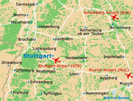
With a population of more than 600,000 and a host of vineyards and meadows, the city of Stuttgart is perhaps best known for being the home of the world-famous Mercedes-Benz can manufacturers. Located in the Baden-Württemberg area of south-western Germany, Stuttgart is close to a number of towns, including Heilbronn to the north, and both Mannheim and Heidelberg to the north-west.
Also to the north-west of Stuttgart, Frankfurt Am Main lies around 200 km / 124 miles from the city and can be reached in just over two hours. To the south of Stuttgart you will find Stuttgart Airport (STR), close to Echterdingen.
Stuttgart is well connected to the rest of the country by many major roads which radiate from the centre. These include the B10 (Uferstrasse), the B27, the B29, the B295, the A8 / E52 and the A81 / E41.
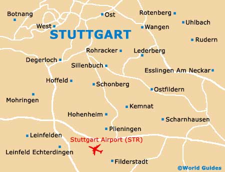
Stuttgart Airport (STR) Maps: Important City Districts
Stuttgart is home to countless densely planted woodlands and more than 500 different vineyards and wineries. Dating back to the mid-10th century, the city boasts a rich heritage and is located in an appealing valley setting, on the western side of the Neckar River.
Many attractive vineyards overlook central Stuttgart, a number of which are planted on scenic hillsides. Within the city itself, much of the area is hilly and a number of the streets are edged with stairs. Stuttgart's train station (Hauptbahnhof) lies on the northern side of the city, close to the Konigstrasse area, where you will find a large concentration of shops.
Map of Germany

Map of Stuttgart